 Support TT
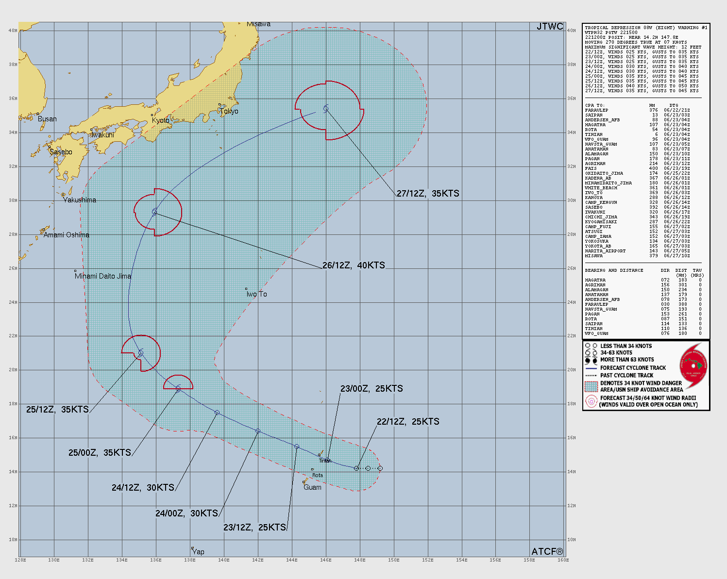
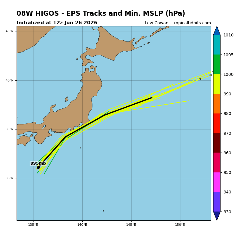
Location: 34.0°N 137.5°E
Maximum Winds: 45 kt Gusts: N/A
Minimum Central Pressure: 989 mb
Environmental Pressure: N/A
Radius of Circulation: N/A
Radius of Maximum wind: 70 nm
34 kt Wind Radii by Quadrant:
Maximum Winds: 45 kt Gusts: N/A
Minimum Central Pressure: 989 mb
Environmental Pressure: N/A
Radius of Circulation: N/A
Radius of Maximum wind: 70 nm
34 kt Wind Radii by Quadrant:
| 0 nm | 50 nm |
| 30 nm | 60 nm |


